
Littoral Waters: What the Term Means and Why It Is Hard Sailing
Littoral means near the shore. A guide to the littoral zone, its depth limits, why coastal water is hard to navigate and naval littoral use.
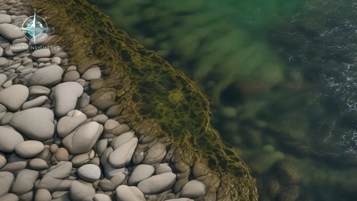
Littoral means belonging to the shore. In marine science the littoral zone is the band of sea and seabed closest to land, running from the highest reach of the tide out to the depth where wave action stops disturbing the bottom. That is commonly 5 to 10 meters (16 to 33 ft) below the low-water line, depending on the strength of storm waves.
Navies use the word differently, applying it to shallow coastal seas where warships operate within reach of land. Both senses point at the same water: the shallowest, busiest and most demanding part of the ocean.
The bands inside the littoral zone
Marine ecologists split the littoral into layers that follow the tide, and the vocabulary turns up in dredging permits and port environmental statements.
- Supralittoral , the splash zone above the high-water mark, wetted by spray rather than by the tide itself.
- Eulittoral , the true intertidal band between mean high and mean low water, exposed and submerged twice a day on most coasts.
- Sublittoral , permanently submerged but still reached by light and by wave energy at the bed.
Lakes and rivers borrow the same word for the shallow, light-reached margin where rooted plants grow. The principle does not change: littoral water is water thin enough for the bottom to matter.
Why littoral water is the hardest water to work
Ocean passage planning is mostly a question of weather and traffic. Littoral passage planning is a question of the seabed, and the failure modes are different.
- Depth is a moving target. Charted soundings are referenced to a datum, usually the lowest astronomical tide, so real depth changes by the hour. Tidal range in some estuaries exceeds 10 meters (33 ft).
- Squat eats under-keel clearance. A ship moving through shallow water sinks bodily and changes trim, and the effect grows sharply as the depth-to-draft ratio falls. Cutting speed is the only quick remedy.
- The bottom moves. Sandbanks migrate and survey data ages. A chart showing a channel accurately is describing the day it was surveyed, not today.
- Tidal streams set across channels. Cross-set in a narrow buoyed channel is a classic route to a grounding on a well-charted bank.
- Sea room disappears. Bank effect, interaction between passing ships and constrained turning circles all bite before the echo sounder alarm does.
Littoral in naval usage and why it changed warship design
Navies use littoral to describe operations close to a hostile shore, and the requirements invert blue-water practice: shallow draft, agility in confined water, mine countermeasures, and anti-submarine detection in conditions where sonar performance degrades badly because sound reflects off both the surface and the bottom. The United States Navy built a whole class, the littoral combat ship, around that mission set.
Merchant crews meet the consequences indirectly, as exercise areas, firing ranges and mine countermeasure operations promulgated in Notices to Mariners.
The littoral is where marine regulation concentrates
Most environmental rules that constrain a ship take effect near the coast, because that is where the harm lands and where enforcement is practical.
- Ballast water uptake is discouraged in shallow, turbid or sediment-laden water, which describes many littoral berths and approaches.
- Anchor damage to seagrass and coral is an active enforcement target in Australian, European and North American waters.
- MARPOL special areas and emission control areas mostly follow coastlines rather than open ocean.
- Hull biofouling matters most here, since littoral water is where non-native species establish and spread.
Terms that get confused with littoral
- Intertidal covers only the ground between the tide marks, a subset of the littoral.
- Neritic describes the water column over the continental shelf, extending well beyond the littoral.
- Pelagic is the open water column; benthic refers to the seabed and the life on it.
- Coastal state is a legal category from the law of the sea, not a physical description of water.
Why the word is appearing more often in commercial work
Offshore wind foundations, interconnector cables, aquaculture leases, dredged approach channels and port expansions all compete for the same narrow strip of shallow water. Passage plans through northern European and North American coastal waters now routinely route around structures that did not exist ten years ago. Treat every littoral leg as its own planning problem, with a stated tidal window, a contingency anchorage and an abort point agreed before the ship commits.
The Marine Insight 360 Knowledge Base covers under-keel clearance policy and passage planning in restricted waters in more detail.
The enforcement in littoral water is national, not international. The USCG inspects ballast water treatment systems and holds the type approval list that decides which units are acceptable in United States waters. AMSA polices anchoring damage on the Great Barrier Reef and runs the compulsory pilotage requirement in the inner route. The MCA does the same work in United Kingdom coastal water.
Survey currency is the other national responsibility. National hydrographic offices decide when a channel is resurveyed. The source data diagram on the chart shows how old the soundings under the ship actually are. Reading that diagram before a shallow-water leg is the habit that separates a planned under-keel clearance from an assumed one. Charted depth is only as current as the survey behind it.
Sources and further reading
What to read next
Recommended Reading
The Arabian Sea Heat Crisis: What a Marine Heatwave Means for Ships and Coasts
A maritime minister has urged urgent action on the Arabian Sea heat crisis. What a marine heatwave is, why cyclone risk rises, and what it changes on board.
Black Water Flowing Into the Ocean After a Hurricane: What It Means for Ships
What black water flowing into the ocean after a hurricane like Sally really carries, the MARPOL Annex IV sewage limits, and how crews protect ships and health.
Iran's Threat to Burn Ships in the Strait of Hormuz: What It Means at Sea
Iran has threatened to burn ships in the Strait of Hormuz and mined the corridor. What the threat means for transit planning, war risk cover and crews.