
How Katabatic Winds Form and Why They Catch Ships Out
Katabatic winds form when cold dense air drains downhill under gravity. How they build, where they hit hardest, and how to plan anchoring around them.
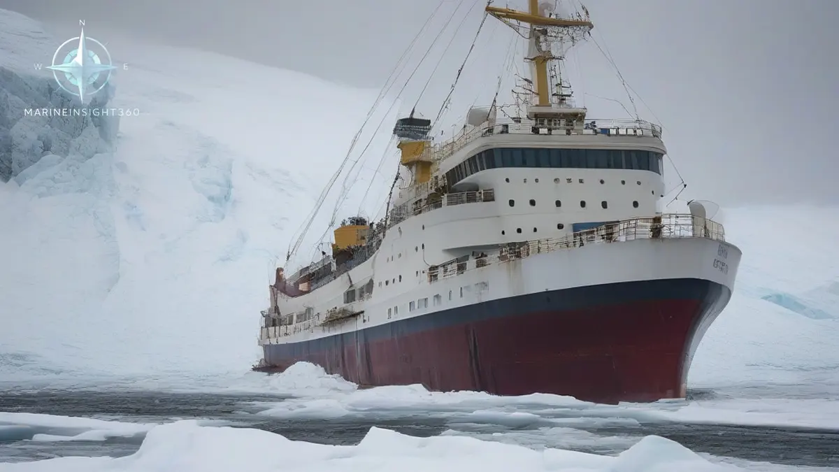
How do katabatic winds form? Katabatic winds form when air on a cold, elevated surface loses heat, becomes denser than the air around it, and drains downhill under gravity. Clear skies and a light gradient wind over a glacier, snowfield or high plateau chill a shallow layer near the ground. That cold layer is heavier than the free air at the same level. It slides down the slope, accelerating as it goes, and funnels through valleys and fjords.
It then bursts out over the water as a narrow band of very strong offshore wind. Masters working the Norwegian coast, Southeast Alaska and New Zealand's Fiordland meet it most often.
The reason this matters at sea is that the mechanism is local. Katabatic flow is generated by terrain, not by the synoptic pressure pattern, so it can produce gale or storm force wind on a day when the surface analysis shows a slack gradient. A ship anchored off a steep coast can go from calm to 50 knots of offshore wind in minutes with no change on the barometer.
The physics in sequence
- Radiative cooling. On a clear night, or continuously over polar ice, the surface radiates heat away and chills the air immediately above it.
- Density contrast. That chilled layer, often only tens to a few hundred meters deep, becomes denser than air at the same height further out.
- Gravity drainage. Because the layer sits on a slope, the horizontal pressure difference drives it downhill. Steeper and longer slopes give stronger acceleration.
- Channelling. Valleys, glacier tongues and fjords squeeze the flow, raising speed in the same way a nozzle does.
- Exit and jump. Where the flow reaches the coast it spreads out, often forming a hydraulic jump, and the strongest wind usually persists for a limited distance offshore before mixing away.
Because the flow is deep and persistent over ice sheets, the Coriolis effect deflects it as it runs, which is why Antarctic katabatic streams curve rather than heading straight downslope. Over shorter mountain slopes the deflection is negligible and the wind runs close to the fall line.
Where mariners meet them
The strongest examples come off the polar ice sheets. Cold air pools over the interior of the Antarctic ice sheet and diverges outward along the slopes toward the coast, with sustained speeds of 20 to 30 m/s and far higher gusts where coastal valleys concentrate the flow. Adelie Land is the textbook case.
On the east coast of Greenland the same process produces the piteraq , which is at its most violent when a low pressure system approaches the coast and steepens the pressure gradient on top of the drainage flow. That combination is what turns a manageable downslope wind into a survival-grade event around Tasiilaq.
Outside the polar regions, the same physics shows up in commercially busy water:
- The bora on the eastern Adriatic, where cold air from the Dinaric plateau falls onto the Croatian coast in violent, gusty bursts affecting Trieste, Rijeka and the Kvarner.
- Williwaws in the Strait of Magellan, Tierra del Fuego, the Aleutians and Patagonian channels, where sudden gusts hit anchored vessels from steep terrain.
- The Taku wind near Juneau, Alaska, and comparable outflow winds from British Columbia inlets.
- Fjord outflow in Norway, Greenland, Chile and Alaska, where cruise ships, expedition vessels and fishing craft operate close under high ground.
Katabatic is not the same as foehn
Both are downslope winds, and the terms get mixed up. A katabatic drainage wind is cold at the surface because it starts cold and stays relatively cold. A foehn or chinook descends and warms by compression, arriving on the lee side as a dry, warm, often dust-laden wind.
A gap wind such as the mistral is different again: it is driven by a pressure difference across a mountain gap rather than by pure gravity drainage, though the effects on a small vessel look similar.
Why the forecast will not save you
Katabatic events are mesoscale. Coarse global models smooth away the terrain that generates them, so the wind often does not appear on the synoptic chart at all. High-resolution regional models handle them better, but the practical defense is still local knowledge from pilot books and sailing directions, which document the named winds, their season and their usual timing.
The classic setup is a clear, cold night with light gradient wind, high ground covered in snow or ice close to the coast, and a valley or glacier mouth pointing at your position. Onset is often fastest in the hours before dawn, when surface cooling has had the longest run.
Handling the operational risk
Anchoring is where katabatic wind does most of its damage. An offshore blast from a valley mouth arrives on the beam or the quarter of a vessel lying to a light breeze, breaks out the anchor before it can reset, and drives the ship into deeper water where the cable cannot hold. Practical measures used by operators working steep coasts include:
- Avoid anchoring directly off a valley, glacier tongue or fjord mouth if a berth further along the coast is available.
- Increase scope beyond the normal ratio and pick holding ground that will take a sudden sideways load.
- Keep the main engine on short notice and an anchor watch that monitors wind, not just position.
- Plan crane, tender and pilot ladder work for the part of the day when drainage flow is weakest, usually the afternoon after surface heating.
- Brief the bridge team that a rise from calm to storm force can occur inside ten minutes.
For voyages into Greenland, Svalbard, Patagonia or the Antarctic Peninsula, read the relevant pilot book section on local winds during the passage plan stage rather than on arrival, and cross-check it against the polar operational limitations in the ship's Polar Water Operational Manual.
The requirement to plan for this is not advisory in polar waters. SOLAS Chapter XIV makes the IMO Polar Code mandatory, and a ship trading there carries a Polar Ship Certificate and a Polar Water Operational Manual that must set out the operational limits and the weather conditions the vessel is assessed for. Flag administrations and port state control officers, AMSA and Transport Canada among them, check both documents.
Expedition operators lose people and equipment rather than ships. A shore party landed in a calm fjord can be cut off when the tender run becomes unworkable within minutes, and inflatable boats are swamped or blown offshore. Gangways, pilot ladders and davit-launched craft are damaged in the same gusts. The common mistake is treating a benign synoptic chart as a forecast for a landing site under high ground.
Sources and further reading
- Mesoscale modeling of katabatic winds over Greenland (Ohio State Polar Meteorology Group)
- Interaction of katabatic winds and mesocyclones near the eastern coast of Greenland, Meteorological Applications
What to read next
Recommended Reading
Marine Scrubbers: Types, How They Work and Where the Rules Are Tightening
How marine scrubbers strip sulfur from ship exhaust, the difference between open-loop, closed-loop and hybrid systems, and where washwater discharge is banned.
10 of the World's Greatest Natural Harbors, and Why They Matter
What makes a natural harbor, and ten of the world's greatest: Sydney, San Francisco, New York, Rio, Halifax and more, with the geography that shelters them.
Waterspouts: How They Form and How to Steer Clear at Sea
Waterspouts come in fair weather and tornadic forms. How they build, the five stage life cycle, and the NOAA rule for steering clear of one.