
Why the Red Sea Matters: Its Name, Its Trade Route and Its Risks
Why the Red Sea is called red and why it matters to shipping: the Suez route, Bab el-Mandeb, and what transits mean for crews and operators.
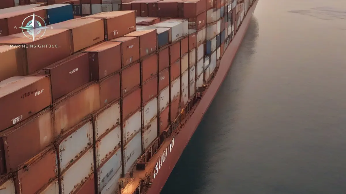
Red Sea transits matter because this narrow sea is the water bridge of the Suez route, the shortest sea lane between Europe and Asia. Roughly a tenth of global seaborne trade funnels through it. The name is a separate puzzle: the sea most likely takes it from blooms of Trichodesmium erythraeum, a cyanobacterium that periodically turns its blue green water reddish brown.
Everything enters and leaves through two gates: the Suez Canal in the north and the Bab el-Mandeb Strait in the south. That geography explains both its commercial weight and its vulnerability.
Why the Red Sea is called red
The most widely accepted explanation is biological. Trichodesmium erythraeum, a nitrogen fixing cyanobacterium, blooms seasonally across the sea's surface. Dying blooms discolor the normally clear water with reddish brown patches, and the organism's reddish pigments gave the species its Latin name.
The name itself is ancient. Greek geographers called it Erythra Thalassa, literally the red sea, long before anyone understood algal blooms. A competing theory holds that some ancient cultures linked colors to compass directions, with red standing for south, which would make Red Sea a directional label rather than a description. The label stuck across languages and charts, and it remains one of the oldest place names still in daily commercial use.
Either way, the water is usually a deep blue green. Sailors transiting today are far more likely to notice its clarity, and its heat, than any red tint.
The Suez route: why this sea carries a tenth of world trade
Since the Suez Canal opened in 1869, the Red Sea has connected the Mediterranean to the Indian Ocean without the long passage around southern Africa. Around 12 percent of global trade moves through the canal in a normal year, and all of it must transit the full length of the Red Sea.
At the southern end, the Bab el-Mandeb Strait, roughly 30 km (18 miles) wide at its narrowest, ranks among the busiest oil chokepoints on earth. The US Energy Information Administration tracks millions of barrels of crude and products moving through it daily, alongside container tonnage and liquefied natural gas.
How the Red Sea route compares with the Cape of Good Hope
The Suez route saves enormous distance on Asia to Europe trades. A container ship from Singapore to Rotterdam sails thousands of miles fewer via the Red Sea than around southern Africa, which typically translates into more than a week of saved steaming time.
That saving is the canal's entire business case, and it explains why tolls, insurance premiums and security conditions in this sea move freight rates worldwide. When transits fall, the cost of the diversion lands directly on shippers and, eventually, on consumers.
A young ocean that is still opening
Geologically, the Red Sea is an infant ocean. It occupies the rift where the African and Arabian plates are pulling apart, and it widens by a small amount every year. Depths exceed 2,000 meters (6,600 feet) in the central trough, and the northern end splits around the Sinai Peninsula into the Gulf of Suez, the shipping route, and the deep Gulf of Aqaba.
Little rain, no permanent rivers and fierce evaporation make it one of the saltiest open seas anywhere, at roughly 40 parts per thousand. Surface water stays warm all year, which supports extensive coral reef systems along both coasts and makes the sea a major diving destination.
What Red Sea transits mean for operators and crews
Security has shaped Red Sea routing decisions for years. Attacks on shipping near Bab el-Mandeb have periodically pushed operators to divert around southern Africa, accept higher war risk premiums or harden vessels before transit. Voyage planning here is never purely commercial.
The environment adds its own demands. High sea temperatures work engine cooling systems hard, dust from the surrounding deserts loads air filters, and dense traffic converging on the canal and the strait requires disciplined watchkeeping.
Crews also plan for the canal itself: convoy timings, pilotage, mooring boats and the paperwork of one of the most administratively involved transits in commercial shipping.
For the industry, the Red Sea is the clearest reminder that world trade depends on a handful of narrow waters. The Ports section of Marine Insight 360 tracks the canals and chokepoints that shape these routes.
Transits through this sea are managed through a reporting system rather than routing alone. Ships entering the Voluntary Reporting Area register with UKMTO, which covers the Red Sea, the Gulf of Aden and the northern Indian Ocean, and send position reports while inside it. Operators work to the industry Best Management Practices, and the naval forces patrolling the area build their picture from those reports.
The chokepoint risk is not only hostile. When the containership Ever Given grounded in the Suez Canal in March 2021 she blocked it for six days, and hundreds of ships waited at both ends or diverted around Africa. A grounding, a steering failure or a blackout in a channel this narrow stops a tenth of world trade, which is why transits run under pilotage with tugs stationed along the cut.
Sources and further reading
- The Bab el-Mandeb Strait is a strategic route for oil and natural gas shipments (U.S. EIA)
- Bab el-Mandeb Strait (Britannica)
- Is the Red Sea really red? (Live Science)
- The Bab el Mandeb and the Red Sea shipping crisis (National Geographic)
What to read next
Recommended Reading
Consignee: Who Actually Receives the Cargo, and Why the Name on the Bill Matters
The consignee is the party entitled to receive a shipment. What the role means on a bill of lading, how it differs from shipper and notify party, and the risks.
UAE Suspends Trade With Iran Following Antiship Missile Strike
Find out how the UAE’s trade halt with Iran affects shipping routes, insurance, and port operations worldwide.
Which Country Has a Man Made Canal? The Waterways That Carry World Trade
The countries with man made canals that shape world trade: Egypt's Suez, Panama's locks, Germany's Kiel and Greece's Corinth, with key facts.