
Is the Tasman Sea Rough? What Crews Should Expect on the Crossing
The Tasman Sea is rough for much of the year, with 3 to 4 metre swells common and storm seas above 10 metres. Why it behaves this way and how to plan for it.
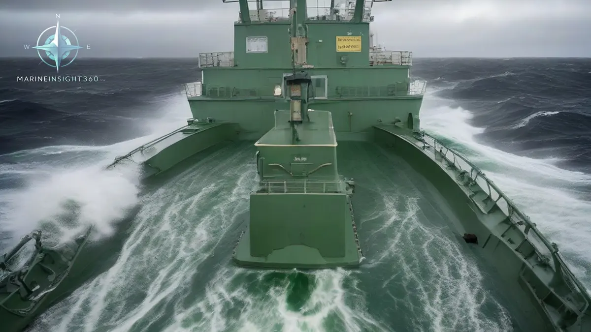
Is the Tasman Sea rough? Yes, genuinely, and for a larger share of the year than most water at the same latitude. Swells of three to four metres (10 to 13 ft) are routine rather than exceptional, and storm systems regularly build seas above ten metres (33 ft). Australians and New Zealanders call the crossing the Ditch, which understates it.
Sydney to Auckland is only about 1,150 nautical miles, but a ship can meet two or three separate frontal systems on the way across, sometimes with only a day between them.
The reason is structural rather than seasonal bad luck. The Tasman sits directly in the path of the eastward-moving weather that circles the Southern Ocean, with nothing upwind to break it.
Why the Tasman behaves the way it does
Three separate mechanisms stack on top of each other.
The first is the Roaring Forties. Cold fronts generated in the Southern Ocean track east across the Tasman in a near-continuous procession, particularly in the southern winter. Each front brings a wind shift, a squall line and a new swell train at a different angle to the one already running.
The second is the temperature contrast. The East Australian Current carries warm water south along the New South Wales coast, and it meets much colder southern water in the middle of the sea. That contrast feeds rapid cyclogenesis, which is why lows over the Tasman can deepen faster than a routine forecast run suggests.
The third is swell interaction. Southern Ocean swell arriving from the southwest meets Pacific swell from the east and locally generated wind sea from a passing front. Crossing swell trains produce steep, short-period, confused seas rather than the long regular swell a ship can be trimmed and steered for, and they are what make the Tasman uncomfortable out of proportion to the recorded wave height.
The seasons, and what each one actually delivers
- May to September. The worst of it. Frontal passages are frequent, gales are common and the gaps between systems can be as short as a day and a half.
- November to March. The usual planning window for a voluntary crossing. Conditions are more settled on average, but the summer months bring their own hazard in the form of decaying tropical cyclones tracking south from the Coral Sea.
- Shoulder months. April and October are transitional and unreliable. A settled forecast can still be overtaken by a fast-moving front.
Even in the best window, a Tasman crossing should be treated as a heavy weather passage that might turn out to be an easy one, not the reverse.
The two local hazards worth naming
East coast lows form off the New South Wales coast, often intensifying very quickly. They generate damaging winds and large seas close inshore, and they are a recurring cause of ships being told to leave anchorages off Newcastle and Sydney and stand out to sea.
Bass Strait , at the southwestern corner of the Tasman, is shallow, typically in the range of fifty to eighty metres. Southern Ocean swell entering that depth shortens and steepens dramatically, which is why the Strait produces seas that are far worse than the wind alone would explain. The 1998 Sydney to Hobart race, in which six sailors died in a severe storm, remains the reference case for how fast conditions in that corner can become survival conditions.
What rough Tasman weather does to a ship
- Container losses. The Tasman and the approaches to New Zealand ports have a long record of boxes lost overboard. Confused seas produce rolling and pitching combinations that lashing systems are least suited to.
- Parametric rolling. Container ships and car carriers in a head or following sea with a period close to half the ship's roll period can build very large roll angles quickly. Crossing swell in the Tasman makes the conditions for it more likely than a single clean swell would.
- Bow and forecastle damage. Green water forward damages hatch covers, breakwaters, air pipes and bridge front windows on ships that press on too long.
- Cargo shift. Steel, project cargo and bulk cargoes with liquefaction risk all need to be secured for a genuinely heavy passage, not a nominal one.
- Crew injury. Most Tasman injuries are not dramatic. They are falls on stairs, galley burns and hands caught while securing gear that should have been secured before the front arrived.
Planning a Tasman passage properly
- Use a weather routing service and treat the frontal timing as the primary constraint. Deviating to take a front on a better heading usually costs less than the damage from taking it on the beam.
- Secure for sea before departure, not when the barometer starts falling. There is rarely a quiet interval once the passage begins.
- Plan ballast and trim for the expected sea state rather than for the arrival draught alone, and keep slack tanks to a minimum.
- Brief the crew on restricted deck access and fix the point at which the main deck is closed, before it becomes a judgement call in the dark.
- Watch the roll period against the encounter period if the ship is prone to parametric rolling, and alter course or speed early rather than waiting for the first heavy roll.
- Check the New Zealand and Australian met warnings and coastal forecasts as well as the routing provider's output, because the local services resolve east coast lows better.
The honest summary for anyone planning a crossing
The Tasman is not a survival passage for a well-found commercial ship, and thousands of crossings are made each year without incident. It is, however, a stretch of water that punishes optimistic scheduling. Ships that arrive damaged on the Tasman are usually ships that were held to a berth window through a front they should have avoided.
For heavy weather preparation checklists and cargo securing practice that apply directly to this passage, work through the Shipboard Operations material on Marine Insight 360.
Two agencies set the practical rules for this water. AMSA runs the Australian search and rescue region and inspects ships arriving from the crossing. It has detained ships after container losses off the New South Wales coast where cargo securing was found defective. Maritime New Zealand does the equivalent on the eastern side. Both are Tokyo MoU members, so an arrival showing weather damage attracts a closer inspection.
The forecast side has its own named sources. The Australian Bureau of Meteorology and MetService in New Zealand issue the gale and storm warnings for the Tasman forecast areas. Where a ship is damaged or a life is lost, the investigation goes to a national safety investigator. That is the Australian Transport Safety Bureau, or the Transport Accident Investigation Commission in New Zealand.
Sources and further reading
- Is the Tasman Sea Rough? And the best time to cross it
- Tasman Sea, World Cruising and Sailing Wiki
- Sailing Australia to New Zealand: Tasman Sea Guide
What to read next
Recommended Reading
Why Is the Tasman Sea So Dangerous? Crossing the Ditch
Why the Tasman Sea is so dangerous: Roaring Forties storms, steep seas against the East Australian Current, cold water and extreme remoteness.
Why Is the Bay of Biscay So Rough? The Physics of a Feared Crossing
Why is Bay of Biscay so rough: Atlantic swell steepening on a shallow shelf, a funnel shaped coast and winter storms, plus practical crossing advice.
Iran and Russia Conduct Joint Naval Exercises: What Merchant Crews Should Expect
Iran and Russia held joint naval exercises in the Gulf of Oman and northern Indian Ocean. Here is how merchant crews plan, report and transit around them.